
The Silver Comet Trail
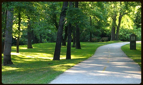
The Silver Comet Trail is located 13 miles northwest of Atlanta, GA. It's free of charge and travels west through Cobb, Paulding, and Polk counties. This quiet, non-motorized, paved trail is for walkers, hikers, bicyclists, rollerbladers, horses, dog walkers, and is wheelchair accessible.
The Silver Comet Trail is 61.5 miles long and starts at the Mavell Road Trailhead in Smyrna, Georgia. It ends at the Georgia/Alabama state line, near Cedartown
and The Esom Hill Trailhead. At the Georgia/Alabama state line, the Silver Comet connects to the 33-mile long Chief Ladiga Trail.
Plans are underway to extend the Chief Ladiga an additional 7 miles. Both the Silver Comet Trail and Chief Ladiga are fully paved rail-trails built on abandoned railroad lines.
The combined Silver Comet and Chief Ladiga trail length is estimated to be 94.5 paved miles from Smyrna, Georgia, to Anniston, Alabama.
Please remember to bring plenty to drink for you and your pet. Water fountains along the trail may not be working.
-
New Silver Comet and Chief Ladiga video - Check out the fun video page.
-
New restaurant in Rockmart, The Bricks on South Marble, welcomes Silver Comet visitors.
-
Rockmart Farmers Market next to Silver Comet/Euharlee Creek
-
Silver Comet Map - interactive map for this site, lists trailhead directions and facts.
-
Path Foundation - non-profit, creating trail system in Atlanta area, and Silver Comet
-
Rails-to-Trails Conservancy - US trail database, including rail-trails


© 2015 designed by b# productions created with wix.com
